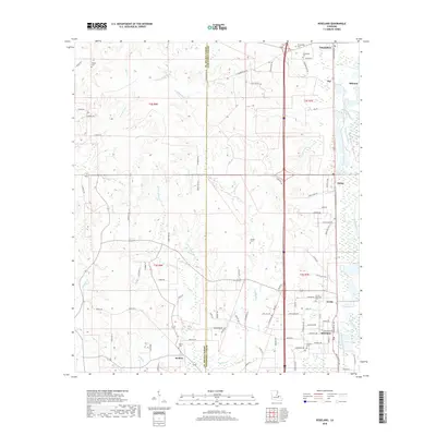
2018 Map of Roseland
USGS Topo · Published 2018About this map
Roseland and the neighboring community of Arcola serve as the primary hubs in this part of Tangipahoa Parish, situated along a busy rail and highway corridor. The landscape is defined by the eastern drainage of the Tangipahoa River and the winding course of Natalbany Cr, with numerous smaller tributaries like Hardy Br and Mud Cr carving through the terrain. The parish line between St. Helena and Tangipahoa is clearly delineated, bisecting rural areas where family-named landmarks such as Phillips Cem and Watson Cem mark long-standing local history.
Find a feature on this map
99 named features on this map. Tap any name to fly to it.
Don’t see what you’re looking for? This feature index may not catch every label — zoom into the map to look around manually.
Map Details
Editions of this 2018 Roseland Map
This is the sole edition of this map. No revisions or reprints were ever made.
Other maps of this area

1940 · Spring Creek
USGS Topo · 1:31,680

1940 · Roseland
USGS Topo · 1:31,680

1942 · Roseland
USGS Topo · 1:31,680

1942 · Montpelier
USGS Topo · 1:31,680

1942 · Liverpool
USGS Topo · 1:31,680

1942 · Loranger
USGS Topo · 1:31,680

1949 · Bolivar
USGS Topo · 1:31,680

1949 · Amite
USGS Topo · 1:31,680

1950 · Kentwood
USGS Topo · 1:31,680

1950 · Greensburg
USGS Topo · 1:31,680