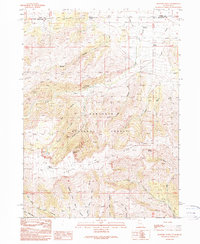
1990 Map of Rosevere Point
USGS Topo · Published 1990About this map
The Sawtooth Mountains dominate this high-altitude landscape along the border of Cassia and Box Elder Counties, where the Idaho and Utah state line intersects the Sawtooth National Forest. This 1990 provisional survey documents a terrain defined by steep ridges and complex drainages, including Rice Canyon, Italian Canyon, and Dunn Canyon. Of significant interest to historians is the presence of the Emigrant Trail cutting through the northern section, marking a historic corridor of western movement. At higher elevations, distinctive landmarks like Rosevere Point and Pinnacle overlook a network of alpine water sources such as Bull Lake, Rosevere Lake, and Hidden Spring. The map also captures the local headwaters for the Raft River system, including the Left Hand Fork and Middle Fork.
Find a feature on this map
41 named features on this map. Tap any name to fly to it.
Don’t see what you’re looking for? This feature index may not catch every label — zoom into the map to look around manually.
Map Details
Editions of this 1990 Rosevere Point Map
This is the sole edition of this map. No revisions or reprints were ever made.
Other maps of this area

1954 · Pocatello
USGS Topo · 1:250,000

1954 · Brigham City
USGS Topo · 1:250,000

1958 · Pocatello
USGS Topo · 1:250,000

1958 · Brigham City
USGS Topo · 1:250,000

1959 · Strevell
USGS Topo · 1:62,500

1959 · Kelton Pass
USGS Topo · 1:62,500

1959 · Park Valley
USGS Topo · 1:62,500

1962 · Brigham City
USGS Topo · 1:250,000

1968 · Naf
USGS Topo · 1:24,000

1968 · Chokecherry Canyon
USGS Topo · 1:24,000