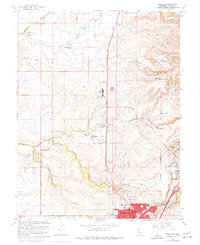
1967 Map of Roseville
USGS Topo · Published 1977About this map
Roseville and Rocklin anchor this mid-century landscape, where the established rail infrastructure of the Southern Pacific meets a sprawling network of family ranches and emerging suburban boundaries. The map documents a transition from extensive agricultural holdings like the W F Fiddyment Ranch and Spring Valley Ranch to more formalized recreational and civic spaces, including the Sierra View Country Club and the Roseville Library.
Find a feature on this map
46 named features on this map. Tap any name to fly to it.
Don’t see what you’re looking for? This feature index may not catch every label — zoom into the map to look around manually.
Map Details
Editions of this 1967 Roseville Map
3 editions found
Other maps of this area

1891 · Sacramento
USGS Topo · 1:125,000

1892 · Sacramento
USGS Topo · 1:125,000

1893 · Sacramento
USGS Topo · 1:125,000

1902 · Fairoaks
USGS Topo · 1:62,500

1910 · Sheridan
USGS Topo · 1:31,680

1910 · Lincoln
USGS Topo · 1:31,680

1910 · Roseville
USGS Topo · 1:31,680

1910 · Pleasant Grove
USGS Topo · 1:31,680

1911 · Arcade
USGS Topo · 1:31,680

1911 · Antelope
USGS Topo · 1:31,680