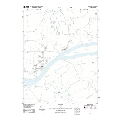
2011 Map of Rosiclare
USGS Topo · Published 2011About this map
Mining operations dominate the landscape around Rosiclare and Elizabethtown along the northern banks of the Ohio River. This 2011 survey illustrates a heavy industrial footprint, specifically highlighting numerous fluorite or lead-zinc extraction points such as the Rosiclare Mine, Hillside Mine, and the Buzzards Roost Shaft Alcoa Mine. These sites are densely clustered near the riverbank, signaling a deep reliance on the waterway for transport. To the north, the Illinois Furnace Picnic Area and Iron Furnace Point of Interest signify the region's long heritage in iron smelting. Cultural and genealogical sites are frequent throughout the quadrangle, including the Stone Church Cemetery and Hardin Cemetery. The topography transitions from the river's floodplains, where Hurricane Island and Barnett Lake sit, to the interior hills where names like Whoopie Cat-Lake and Keeling Hill add local character to the rural terrain.
Find a feature on this map
88 named features on this map. Tap any name to fly to it.
Don’t see what you’re looking for? This feature index may not catch every label — zoom into the map to look around manually.
Map Details
Editions of this 2011 Rosiclare Map
This is the sole edition of this map. No revisions or reprints were ever made.
Other maps of this area

1916 · Shawneetown
USGS Topo · 1:62,500

1916 · Fords Ferry
USGS Topo · 1:62,500

1916 · Golconda
USGS Topo · 1:62,500

1916 · Equality
USGS Topo · 1:62,500

1920 · Goloonda
USGS Topo · 1:48,000

1921 · Fords Ferry
USGS Topo · 1:48,000

1921 · Golconda
USGS Topo · 1:62,500

1925 · Cave In Rock
USGS Topo · 1:62,500

1949 · Paducah
USGS Topo · 1:250,000

1950 · Paducah
USGS Topo · 1:250,000