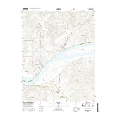
2015 Map of Rosiclare
USGS Topo · Published 2015About this map
The Ohio River carves a deep boundary through this riverine landscape, separating the rugged Illinois hills from the Kentucky lowlands. On the northern bank, the historic river towns of Rosiclare and Elizabethtown serve as primary hubs for the region, where the street grids meet the water's edge near Hurricane Island. The terrain inland is defined by the dense woodlands of the Shawnee National Forest, marked by family-named landmarks like Keeling Hill and Lavender Hill. A network of rural cemeteries, including Stone Church Cem and Critchlow Cem, are scattered across the uplands, providing a clear record of generations of settlement. In Kentucky, the small communities of Carrsville and Milford sit along winding creeks like Thrilkeld Br and Deer Creek, which drain into Barnett Lake and the larger river system, illustrating the agricultural and maritime character of the borderlands.
Find a feature on this map
63 named features on this map. Tap any name to fly to it.
Don’t see what you’re looking for? This feature index may not catch every label — zoom into the map to look around manually.
Map Details
Editions of this 2015 Rosiclare Map
This is the sole edition of this map. No revisions or reprints were ever made.
Other maps of this area

1916 · Shawneetown
USGS Topo · 1:62,500

1916 · Fords Ferry
USGS Topo · 1:62,500

1916 · Golconda
USGS Topo · 1:62,500

1916 · Equality
USGS Topo · 1:62,500

1920 · Goloonda
USGS Topo · 1:48,000

1921 · Fords Ferry
USGS Topo · 1:48,000

1921 · Golconda
USGS Topo · 1:62,500

1925 · Cave In Rock
USGS Topo · 1:62,500

1949 · Paducah
USGS Topo · 1:250,000

1950 · Paducah
USGS Topo · 1:250,000