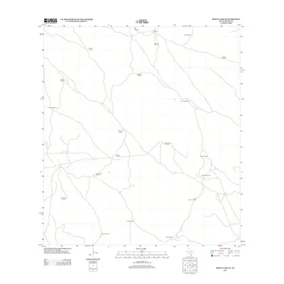
2013 Map of Rosita Lake NE
USGS Topo · Published 2013About this map
Isolated windmills dominate the arid coastal plains of Kenedy County on this 2013 survey. The landscape is defined by an extensive network of water pumping stations, many bearing Spanish names that suggest deep ties to the region's ranching heritage. Features like San Jose Windmill, El Burro Windmill, and Charco Blanco Windmill are connected by a web of unimproved 4WD tracks, indicating a sparsely populated environment dedicated to large-scale land management. The presence of named sites such as Huisatcho Windmills and Campo Verde Windmill reflects the critical importance of water access in this South Texas territory. For local historians or genealogists, these labels provide a specific geographic anchor for the families and operations that have stewarded this terrain into the early 21st century.
Find a feature on this map
21 named features on this map. Tap any name to fly to it.
Don’t see what you’re looking for? This feature index may not catch every label — zoom into the map to look around manually.
Map Details
Editions of this 2013 Rosita Lake NE Map
This is the sole edition of this map. No revisions or reprints were ever made.
Other maps of this area

1921 · Tarida Ranch
USGS Topo · 1:62,500

1923 · Lopena Island
USGS Topo · 1:62,500

1923 · Saltillo Ranch
USGS Topo · 1:62,500

1952 · South of Potrero Lopeno NW
USGS Topo · 1:24,000

1952 · Port Mansfield
USGS Topo · 1:24,000

1952 · Potrero Lopeno SW
USGS Topo · 1:24,000

1952 · Potrero Lopeno
USGS Topo · 1:62,500

1952 · South of Potrero Lopeno
USGS Topo · 1:62,500

1953 · Brownsville
USGS Topo · 1:250,000

1956 · Saltillo Well
USGS Topo · 1:24,000