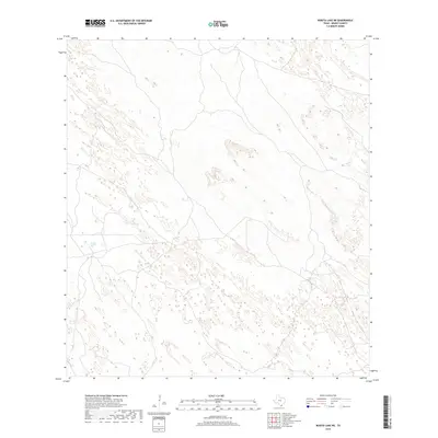
2019 Map of Rosita Lake NE
USGS Topo · Published 2019About this map
The arid landscape of Kenedy County is meticulously documented in this 2019 survey, characterized by a complex network of ephemeral wetlands and shifting sands. The terrain is dominated by small, scattered depressions and topographic undulations, reflecting the unique coastal prairie and sand plain environment of southern Texas. A singular focal point in this vast expanse is the Tecolote Artesian Well, a critical water source located in the southwestern section of the map. This feature represents a vital piece of local infrastructure in a region where surface water is scarce and largely dependent on seasonal fluctuations. The absence of major settlements or primary roads underscores the isolation of this ranching country, where movement is dictated by the natural contours of the land and the location of essential groundwater resources.
Find a feature on this map
1 named feature on this map. Tap any name to fly to it.
Don’t see what you’re looking for? This feature index may not catch every label — zoom into the map to look around manually.
Map Details
Editions of this 2019 Rosita Lake NE Map
This is the sole edition of this map. No revisions or reprints were ever made.
Other maps of this area

1921 · Tarida Ranch
USGS Topo · 1:62,500

1923 · Lopena Island
USGS Topo · 1:62,500

1923 · Saltillo Ranch
USGS Topo · 1:62,500

1952 · South of Potrero Lopeno NW
USGS Topo · 1:24,000

1952 · Port Mansfield
USGS Topo · 1:24,000

1952 · Potrero Lopeno SW
USGS Topo · 1:24,000

1952 · Potrero Lopeno
USGS Topo · 1:62,500

1952 · South of Potrero Lopeno
USGS Topo · 1:62,500

1953 · Brownsville
USGS Topo · 1:250,000

1956 · Saltillo Well
USGS Topo · 1:24,000