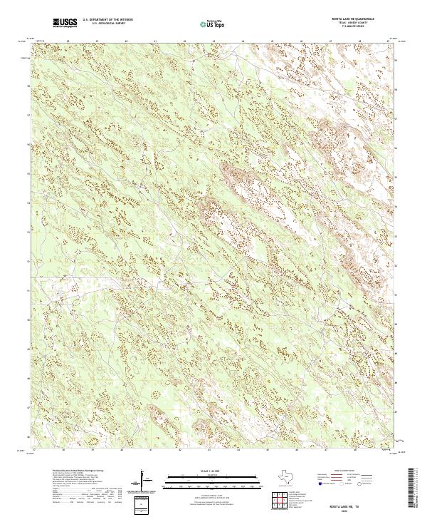
2022 Map of Rosita Lake NE
USGS Topo · Published 2022About this map
Tecolote Artesian Well serves as a singular, vital landmark in this expansive reach of South Texas ranch land. Situated in Kenedy County, the map details a landscape defined by complex contour patterns and low-lying wetland depressions typical of the sandy brush country. The lack of traditional road infrastructure and human settlements highlights the region's historical character as a sparsely populated cattle-grazing territory, where water sources like artesian wells were essential for the survival of livestock and the management of large land holdings. The subtle network of local roads and property boundaries suggests the continued presence of private ranching interests in this corner of the state.
Find a feature on this map
1 named feature on this map. Tap any name to fly to it.
Don’t see what you’re looking for? This feature index may not catch every label — zoom into the map to look around manually.
Map Details
Editions of this 2022 Rosita Lake NE Map
This is the sole edition of this map. No revisions or reprints were ever made.
Other maps of this area

1921 · Tarida Ranch
USGS Topo · 1:62,500

1923 · Lopena Island
USGS Topo · 1:62,500

1923 · Saltillo Ranch
USGS Topo · 1:62,500

1952 · South of Potrero Lopeno NW
USGS Topo · 1:24,000

1952 · Port Mansfield
USGS Topo · 1:24,000

1952 · Potrero Lopeno SW
USGS Topo · 1:24,000

1952 · Potrero Lopeno
USGS Topo · 1:62,500

1952 · South of Potrero Lopeno
USGS Topo · 1:62,500

1953 · Brownsville
USGS Topo · 1:250,000

1956 · Saltillo Well
USGS Topo · 1:24,000