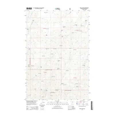
2014 Map of Ross Canyon
USGS Topo · Published 2014About this map
Gallatin National Forest encompasses the southern portion of this landscape, where the terrain rises toward peaks like Red Mtn and Black Butte. The Boulder River cuts through the northwest corner, crossed by the Eightmile Bridge near Old Boulder Rd. This area is defined by a dense network of drainages and canyons, including Ross Canyon and the lengthy Upper Deer Cr. Numerous named gulches such as Sawmill Gulch, Decker Gulch, and Dead Horse Gulch suggest a history of local resource extraction or livestock management. Transportation is limited to a few corridors like MT-298 and Burnt Out Lodge Rd, leaving much of the territory to the high-elevation flats of McKenzie Flats and the intricate ridges separating Rudd Canyon from Wood Gulch.
Find a feature on this map
46 named features on this map. Tap any name to fly to it.
Don’t see what you’re looking for? This feature index may not catch every label — zoom into the map to look around manually.
Map Details
Editions of this 2014 Ross Canyon Map
This is the sole edition of this map. No revisions or reprints were ever made.
Other maps of this area

1891 · Livingston
USGS Topo · 1:250,000

1891 · Big Timber
USGS Topo · 1:125,000

1893 · Livingston
USGS Topo · 1:250,000

1893 · Big Timber
USGS Topo · 1:125,000

1947 · Bozeman
USGS Topo · 1:250,000

1948 · Bozeman
USGS Topo · 1:250,000

1951 · Squaw Peak
USGS Topo · 1:24,000
1951 · Mc Leod
USGS Topo · 1:24,000
1951 · Carney
USGS Topo · 1:24,000

1954 · Big Timber
USGS Topo · 1:24,000