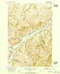
1951 Map of Mc Leod
USGS Topo · Published 1953About this map
Mc Leod and the surrounding mountain valley are defined by a complex irrigation network and a history of early 20th-century settlement along the Boulder River. This 1951 survey documents a landscape of numerous abandoned homesteads, such as the Wagner Homestead and Seaforth Homestead, indicating a period of significant agricultural consolidation or relocation by the early 1950s. The topography is deeply etched by features like Miles Gulch and Edgar Gulch, with the Custer National Forest boundary marking the transition into higher timbered terrain.
Find a feature on this map
48 named features on this map. Tap any name to fly to it.
Don’t see what you’re looking for? This feature index may not catch every label — zoom into the map to look around manually.
Map Details
Editions of this 1951 Mc Leod Map
4 editions found
Other maps of this area

1891 · Livingston
USGS Topo · 1:250,000

1891 · Big Timber
USGS Topo · 1:125,000

1893 · Livingston
USGS Topo · 1:250,000

1893 · Big Timber
USGS Topo · 1:125,000

1947 · Bozeman
USGS Topo · 1:250,000

1948 · Bozeman
USGS Topo · 1:250,000

1951 · Squaw Peak
USGS Topo · 1:24,000

1951 · Kelly Hills
USGS Topo · 1:24,000

1951 · Springdale
USGS Topo · 1:24,000

1951 · Mc Leod Basin
USGS Topo · 1:24,000