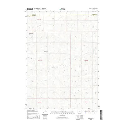
2015 Map of Ross Flat
USGS Topo · Published 2015About this map
Ross Flat sits at the heart of this high-plains landscape where the border of Campbell and Converse counties meets. The terrain is defined by an intricate network of drainage systems, including Antelope Creek, Wind Creek, and Ninemile Creek, which have carved numerous features into the topography such as Moyer Draw, McNaughton Draw, and Red Rock Draw. These seasonal watercourses and landforms illustrate the erosion patterns typical of this Wyoming region, providing a detailed look at the local geography. While largely open country, the map documents the sparse infrastructure of the early 21st century, centered on local routes like County Road 31. This survey provides a baseline for understanding the drainage and ranchland boundaries in a pocket of Wyoming where names like Bull Gulch and Spring Draw reflect the practical relationship between the land and those who manage it.
Find a feature on this map
17 named features on this map. Tap any name to fly to it.
Don’t see what you’re looking for? This feature index may not catch every label — zoom into the map to look around manually.
Map Details
Editions of this 2015 Ross Flat Map
This is the sole edition of this map. No revisions or reprints were ever made.
Other maps of this area

1954 · Artesian Draw
USGS Topo · 1:24,000

1954 · Pine Tree
USGS Topo · 1:24,000

1955 · Newcastle
USGS Topo · 1:250,000

1958 · Newcastle
USGS Topo · 1:250,000

1959 · Coal Draw
USGS Topo · 1:62,500

1960 · Ross
USGS Topo · 1:62,500

1960 · Turnercrest
USGS Topo · 1:62,500

1974 · Reno Junction
USGS Topo · 1:100,000

1979 · Bill
USGS Topo · 1:100,000
1984 · Marsh Draw
USGS Topo · 1:24,000