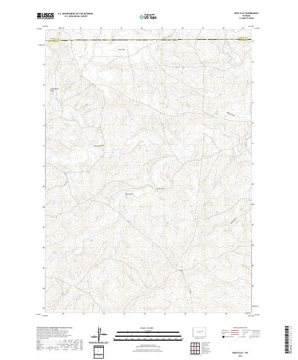
2021 Map of Ross Flat
USGS Topo · Published 2021About this map
Ross Flat characterizes this high plains landscape along the border of Campbell and Converse counties. The area is defined by a complex network of seasonal drainage systems, most notably Antelope Cr and its tributaries which carve through the terrain. Evidence of the region's ranching and rural infrastructure is seen in the path of Nine Mile Creek Rd and Co Rd 31, which provide access across the sectioned townships.
Find a feature on this map
19 named features on this map. Tap any name to fly to it.
Don’t see what you’re looking for? This feature index may not catch every label — zoom into the map to look around manually.
Map Details
Editions of this 2021 Ross Flat Map
This is the sole edition of this map. No revisions or reprints were ever made.
Other maps of this area

1954 · Artesian Draw
USGS Topo · 1:24,000

1954 · Pine Tree
USGS Topo · 1:24,000

1955 · Newcastle
USGS Topo · 1:250,000

1958 · Newcastle
USGS Topo · 1:250,000

1959 · Coal Draw
USGS Topo · 1:62,500

1960 · Ross
USGS Topo · 1:62,500

1960 · Turnercrest
USGS Topo · 1:62,500

1974 · Reno Junction
USGS Topo · 1:100,000

1979 · Bill
USGS Topo · 1:100,000
1984 · Marsh Draw
USGS Topo · 1:24,000