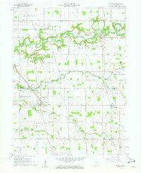
1961 Map of Rossville
USGS Topo · Published 1962About this map
Rossville serves as the primary hub of this early 1960s agricultural landscape, situated at the intersection of several regional roads. The surrounding terrain is defined by the winding course of Wildcat Creek and its various tributaries, including Middle Fork Wildcat Creek and Campbell Run. This survey reveals a community deeply rooted in its local geography, with numerous small family and community burial grounds such as Hufford Cem, Hughes Cem, and Mt Hope Cem dotting the countryside near established churches like Mt Olivet Ch.
Find a feature on this map
33 named features on this map. Tap any name to fly to it.
Don’t see what you’re looking for? This feature index may not catch every label — zoom into the map to look around manually.
Map Details
Editions of this 1961 Rossville Map
2 editions found
Other maps of this area

1953 · Danville
USGS Topo · 1:250,000

1955 · Danville
USGS Topo · 1:250,000

1956 · Danville
USGS Topo · 1:250,000

1961 · Michigantown
USGS Topo · 1:24,000

1961 · Mulberry
USGS Topo · 1:24,000

1961 · Pyrmont
USGS Topo · 1:24,000

1961 · Rossville
USGS Topo · 1:24,000

1961 · Burlington
USGS Topo · 1:24,000

1961 · Frankfort
USGS Topo · 1:24,000

1962 · Deer Creek
USGS Topo · 1:24,000