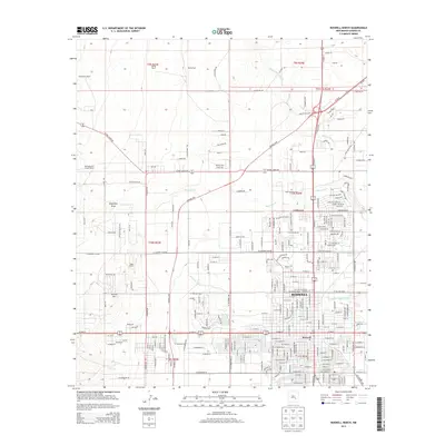
2013 Map of Roswell North
USGS Topo · Published 2013About this map
The city of Roswell is depicted during a period of sustained urban layout, anchored by the sprawling campus of the New Mexico Military Institute. The map captures the convergence of desert hydrology and agricultural heritage, where the Rio Hondo and North Spring River flow through the southern town blocks while several large-scale cattle operations, such as Marley Ranch and the McKnight and Cooper Ranch, occupy the surrounding plains. The local transportation network is defined by the At&SF RR corridor and a system of named draws and hills, including Eightmile Draw and Sixmile Hill. This documentation of the Chaves County landscape shows the precise transition from dense residential streets to the open ranching country of Stewardson Ranch and Marley Farm, illustrating how water sources like Berrendo Cr influenced the placement of these early homesteads.
Find a feature on this map
170 named features on this map. Tap any name to fly to it.
Don’t see what you’re looking for? This feature index may not catch every label — zoom into the map to look around manually.
Map Details
Editions of this 2013 Roswell North Map
This is the sole edition of this map. No revisions or reprints were ever made.
Other maps of this area

1949 · Hondo Reservoir
USGS Topo · 1:24,000

1949 · Roswell North
USGS Topo · 1:24,000

1949 · Roswell South
USGS Topo · 1:24,000

1949 · Corn Ranch
USGS Topo · 1:24,000

1950 · Corn Ranch
USGS Topo · 1:24,000

1950 · South Spring
USGS Topo · 1:24,000

1950 · Bitter Lake
USGS Topo · 1:24,000

1955 · Roswell
USGS Topo · 1:250,000

1958 · Roswell
USGS Topo · 1:250,000

1962 · Roswell
USGS Topo · 1:250,000