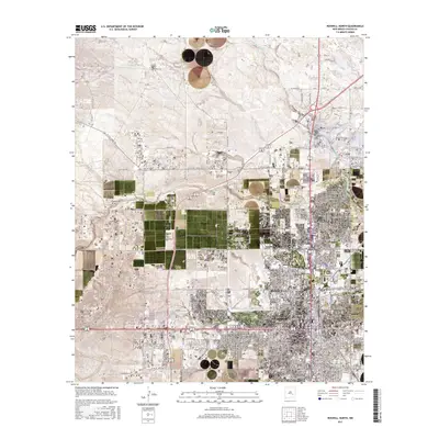
2017 Map of Roswell North
USGS Topo · Published 2017About this map
Roswell is depicted as a growing regional center at the eastern edge of the Pecos Valley, where the grid-like urban layout meets the surrounding high plains. The city's northern expansion is clearly visible, with residential neighborhoods such as Apache Hills Rd and Haley Cir pushing toward the intermittent drainage of Berrendo Cr. The landscape is characterized by its hydraulic features and topographic landmarks, including the prominent Sixmile Hill to the west and the sprawling Eightmile Draw. Heavy transport is anchored by the BNSF Railway corridor, which runs north-south through the city, alongside major thoroughfares like W Pine Lodge Rd and W Country Club Rd. To the south, the Rio Hondo provides a natural boundary to the downtown district, while the outlying townships of t9s r23e and t10s r24e reveal the systematic transition from suburban development to open ranching and agricultural land.
Find a feature on this map
231 named features on this map. Tap any name to fly to it.
Don’t see what you’re looking for? This feature index may not catch every label — zoom into the map to look around manually.
Map Details
Editions of this 2017 Roswell North Map
This is the sole edition of this map. No revisions or reprints were ever made.
Other maps of this area

1949 · Hondo Reservoir
USGS Topo · 1:24,000

1949 · Roswell North
USGS Topo · 1:24,000

1949 · Roswell South
USGS Topo · 1:24,000

1949 · Corn Ranch
USGS Topo · 1:24,000

1950 · Corn Ranch
USGS Topo · 1:24,000

1950 · South Spring
USGS Topo · 1:24,000

1950 · Bitter Lake
USGS Topo · 1:24,000

1955 · Roswell
USGS Topo · 1:250,000

1958 · Roswell
USGS Topo · 1:250,000

1962 · Roswell
USGS Topo · 1:250,000