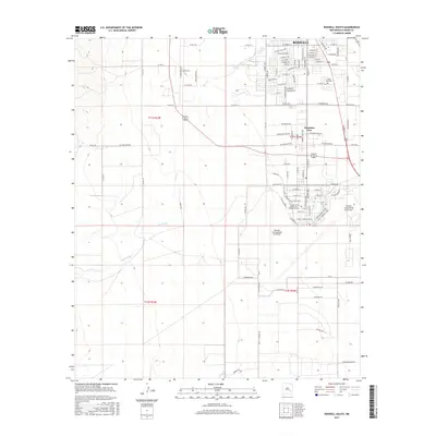
2017 Map of Roswell South
USGS Topo · Published 2017About this map
Roswell and its southern reaches are detailed in this 2017 survey, showcasing the city's significant aviation and educational infrastructure. The prominent Roswell International Air Center occupies a large portion of the landscape, while the Eastern New Mexico Univ - Roswell Campus serves the academic community nearby. The residential settlement of Mountain View appears east of the airfield, providing a clear picture of the city's suburban growth.
Find a feature on this map
108 named features on this map. Tap any name to fly to it.
Don’t see what you’re looking for? This feature index may not catch every label — zoom into the map to look around manually.
Map Details
Editions of this 2017 Roswell South Map
This is the sole edition of this map. No revisions or reprints were ever made.
Other maps of this area

1949 · Hondo Reservoir
USGS Topo · 1:24,000

1949 · Peters Lake
USGS Topo · 1:24,000

1949 · Roswell North
USGS Topo · 1:24,000

1949 · Roswell South
USGS Topo · 1:24,000

1949 · Juan Lake
USGS Topo · 1:24,000

1949 · Corn Ranch
USGS Topo · 1:24,000

1950 · Dexter West
USGS Topo · 1:24,000

1950 · Corn Ranch
USGS Topo · 1:24,000

1950 · South Spring
USGS Topo · 1:24,000

1950 · Bitter Lake
USGS Topo · 1:24,000