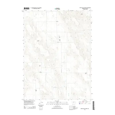
2014 Map of Roten Valley North
USGS Topo · Published 2014About this map
Roten Valley and the surrounding high-plateau "tables" define this portion of the Nebraska sandhills in Custer County. The landscape is marked by a complex system of topographic flats and drainage ditches, such as Stump Ditch, which manage water flow through the varying elevations. For local historians and genealogists, the map preserves the locations of rural burying grounds including Stop Table Cem and the Sells Valley Cem, often the only remaining physical markers of early ranching and farming families in these isolated valley settlements.
Find a feature on this map
14 named features on this map. Tap any name to fly to it.
Don’t see what you’re looking for? This feature index may not catch every label — zoom into the map to look around manually.
Map Details
Editions of this 2014 Roten Valley North Map
This is the sole edition of this map. No revisions or reprints were ever made.
Other maps of this area

1951 · Callaway
USGS Topo · 1:24,000

1951 · Oconto SW
USGS Topo · 1:24,000

1951 · Oconto NW
USGS Topo · 1:24,000

1954 · North Platte
USGS Topo · 1:250,000

1955 · Broken Bow
USGS Topo · 1:250,000

1956 · Broken Bow
USGS Topo · 1:250,000

1956 · North Platte
USGS Topo · 1:250,000

1957 · North Platte
USGS Topo · 1:250,000

1967 · North Platte
USGS Topo · 1:250,000
1972 · Odencranze Table South
USGS Topo · 1:24,000