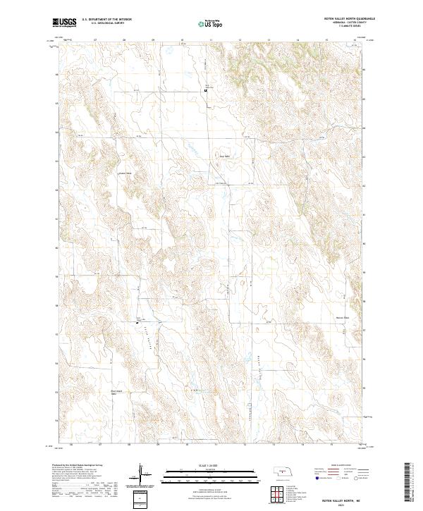
2021 Map of Roten Valley North
USGS Topo · Published 2021About this map
Elevated plateaus known locally as tables define this Custer County landscape, where the flat upland surfaces of Schukar Table, Stop Table, and Hansen Table are dissected by a network of seasonal drainages and man-made irrigation features. This 2021 survey reveals a rural Nebraska environment centered on water management and high-plain agriculture, illustrated by the presence of the Roten Valley Stump Ditch and the Spring Cr Reservoir 25-A. The area’s historical footprint is anchored by two quiet landmarks: the Sells Valley Cem, located near the head of Sells Valley, and the Stop Table Cem situated to the north. A grid of section roads, including Stop Table Rd and Roten Valley Rd, connects these remote tablelands, tracing the township lines of the Public Land Survey System across the rugged breaks of Sand Cr and Cottonwood Cr.
Find a feature on this map
37 named features on this map. Tap any name to fly to it.
Don’t see what you’re looking for? This feature index may not catch every label — zoom into the map to look around manually.
Map Details
Editions of this 2021 Roten Valley North Map
This is the sole edition of this map. No revisions or reprints were ever made.
Other maps of this area

1951 · Callaway
USGS Topo · 1:24,000

1951 · Oconto SW
USGS Topo · 1:24,000

1951 · Oconto NW
USGS Topo · 1:24,000

1954 · North Platte
USGS Topo · 1:250,000

1955 · Broken Bow
USGS Topo · 1:250,000

1956 · Broken Bow
USGS Topo · 1:250,000

1956 · North Platte
USGS Topo · 1:250,000

1957 · North Platte
USGS Topo · 1:250,000

1967 · North Platte
USGS Topo · 1:250,000
1972 · Odencranze Table South
USGS Topo · 1:24,000