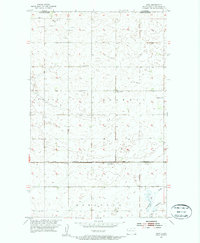
1954 Map of Roth
USGS Topo · Published 1956About this map
The Canada United States border forms the northern limit of this mid-century prairie landscape, where the township sections of Scotia, Scandia, and Eidsvold meet. The settlement of Roth serves as a local focal point along the Great Northern railroad tracks, reflecting the essential link between rural agrarian life and the rail network during this era. The terrain is dotted with numerous small potholes and depressions characteristic of the region, interspersed with a network of section-line roads and local markers.
Find a feature on this map
16 named features on this map. Tap any name to fly to it.
Don’t see what you’re looking for? This feature index may not catch every label — zoom into the map to look around manually.
Map Details
Editions of this 1954 Roth Map
2 editions found
Other maps of this area

1949 · Landa
USGS Topo · 1:24,000

1949 · Landa SW
USGS Topo · 1:24,000

1950 · Landa
USGS Topo · 1:24,000

1950 · Landa SW
USGS Topo · 1:24,000

1954 · Souris SW
USGS Topo · 1:24,000

1954 · Landa SE
USGS Topo · 1:24,000

1954 · Souris
USGS Topo · 1:24,000

1954 · Roth
USGS Topo · 1:24,000

1954 · Minot
USGS Topo · 1:250,000

1958 · Minot
USGS Topo · 1:250,000