
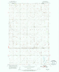
1954 Map of Roth
USGS Topo · Published 1956About this map
The international border between Canada and the United States defines the northern edge of this Bottineau County landscape, where the prairie is dotted with অসংখ্য seasonal wetlands and emerging industrial activity. In the mid-1950s, the small settlement of Roth served as a key point on the Great Northern railroad line, which cuts horizontally across the central plains. Rural education and community life are anchored by landmarks such as School No 1, School No 4, and Lesje Ch, while a lone Grave south of the tracks provides a poignant genealogical detail. The landscape also reflects the early stages of the region's energy development, with scattered Oil Wells and Oil Tanks appearing near the border. In the southeast, Boundary Creek meanders through the township of Eidsvold, contrasting the rigid section lines of the surrounding wheat country.
Find a feature on this map
16 named features on this map. Tap any name to fly to it.
Don’t see what you’re looking for? This feature index may not catch every label — zoom into the map to look around manually.
Map Details
Editions of this 1954 Roth Map
2 editions found
Other maps of this area

1949 · Landa
USGS Topo · 1:24,000

1949 · Landa SW
USGS Topo · 1:24,000

1950 · Landa
USGS Topo · 1:24,000

1950 · Landa SW
USGS Topo · 1:24,000

1954 · Souris SW
USGS Topo · 1:24,000

1954 · Landa SE
USGS Topo · 1:24,000

1954 · Souris
USGS Topo · 1:24,000

1954 · Minot
USGS Topo · 1:250,000

1958 · Minot
USGS Topo · 1:250,000

1980 · Bottineau
USGS Topo · 1:100,000