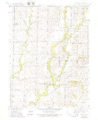
1949 Map of Rothville
USGS Topo · Published 1979About this map
Rothville serves as the central hub of this North Central Missouri landscape, situated where the Atchison Topeka and Santa Fe railroad crosses the meandering course of Yellow Creek. This survey, compiled from 1940s photography and ground mapping, reveals a rural community supported by a mix of agriculture and local resource extraction, evidenced by a Coal Mine and Gravel Pit. The terrain is defined by the convergence of several waterways, including West Yellow Creek, East Yellow Creek, and White Oak Branch.
Find a feature on this map
27 named features on this map. Tap any name to fly to it.
Don’t see what you’re looking for? This feature index may not catch every label — zoom into the map to look around manually.
Map Details
Editions of this 1949 Rothville Map
2 editions found
Other maps of this area

1946 · Brookfield
USGS Topo · 1:62,500

1948 · Brookfield
USGS Topo · 1:62,500

1949 · Mendon
USGS Topo · 1:24,000

1949 · Indian Grove
USGS Topo · 1:24,000

1949 · Sumner
USGS Topo · 1:24,000

1949 · Rothville
USGS Topo · 1:24,000

1949 · Bucklin
USGS Topo · 1:24,000

1950 · Bucklin
USGS Topo · 1:24,000

1950 · Sumner
USGS Topo · 1:24,000

1950 · Rothville
USGS Topo · 1:24,000