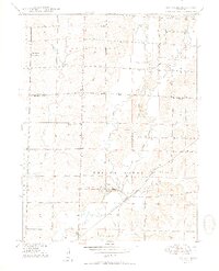
1950 Map of Rothville
USGS Topo · Published 1950About this map
The village of Rothville serves as the focal point of this mid-century survey, situated along the Atchison Topeka and Santa Fe railroad line. The landscape is defined by the winding course of Yellow Creek and its many tributaries, including West Yellow Creek and East Yellow Creek. A network of rural institutions reflects the community structure of the late 1940s, with schools like Hess Sch and Johnson Sch scattered across the township lines of Brookfield and Marceline.
Find a feature on this map
28 named features on this map. Tap any name to fly to it.
Don’t see what you’re looking for? This feature index may not catch every label — zoom into the map to look around manually.
Map Details
Editions of this 1950 Rothville Map
2 editions found
Other maps of this area

1946 · Brookfield
USGS Topo · 1:62,500

1948 · Brookfield
USGS Topo · 1:62,500

1949 · Mendon
USGS Topo · 1:24,000

1949 · Indian Grove
USGS Topo · 1:24,000

1949 · Sumner
USGS Topo · 1:24,000

1949 · Rothville
USGS Topo · 1:24,000

1949 · Bucklin
USGS Topo · 1:24,000

1950 · Bucklin
USGS Topo · 1:24,000

1950 · Sumner
USGS Topo · 1:24,000

1950 · Rothville
USGS Topo · 1:24,000