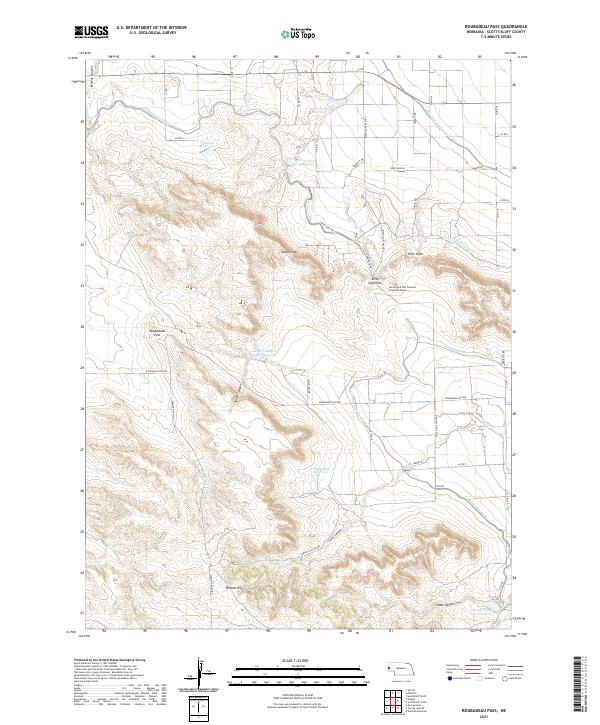
2021 Map of Roubadeau Pass
USGS Topo · Published 2021About this map
The Wildcat Hills dominate the southern half of this landscape, where steep-walled incisions like Cedar Canyon and Carter Canyon cut through the high ridges. This rugged section of the Nebraska Panhandle is defined by its dramatic topographic relief, including the prominent gap at Roubadeau Pass and the isolated heights of Rifle Sight. The transition from the high hills to the valley floor illustrates a complex water management system essential for regional agriculture.
Find a feature on this map
52 named features on this map. Tap any name to fly to it.
Don’t see what you’re looking for? This feature index may not catch every label — zoom into the map to look around manually.
Map Details
Editions of this 2021 Roubadeau Pass Map
This is the sole edition of this map. No revisions or reprints were ever made.
Other maps of this area

1898 · Scotts Bluff
USGS Topo · 1:125,000

1954 · Scottsbluff
USGS Topo · 1:250,000

1958 · Scottsbluff
USGS Topo · 1:250,000

1960 · Stegall
USGS Topo · 1:24,000

1960 · Murray Lake
USGS Topo · 1:24,000

1963 · Scottsbluff South
USGS Topo · 1:24,000

1963 · Mitchell
USGS Topo · 1:24,000

1963 · Scottsbluff North
USGS Topo · 1:24,000
1963 · Morrill
USGS Topo · 1:24,000

1963 · Roubadeau Pass
USGS Topo · 1:24,000