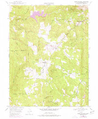
1949 Map of Rough And Ready
USGS Topo · Published 1977About this map
Rough and Ready stands at the heart of this post-war landscape, situated amidst the complex network of water infrastructure that defined the California Gold Country. The legacy of hydraulic and hard-rock mining is visible through extensive waterworks like the China Ditch, Pet Hill Ditch, and Lower Ditch, which once channeled water to claims across the ridges. While several sites like the Black Bear Mine and Mistletoe Mine are noted as inactive by the late 1940s, they mark the historical industry of the Kentucky Ridge area.
Find a feature on this map
36 named features on this map. Tap any name to fly to it.
Don’t see what you’re looking for? This feature index may not catch every label — zoom into the map to look around manually.
Map Details
Editions of this 1949 Rough And Ready Map
3 editions found
Other maps of this area

1888 · Smartsville
USGS Topo · 1:125,000

1891 · Smartsville
USGS Topo · 1:125,000

1892 · Smartsville
USGS Topo · 1:125,000

1894 · Smartsville
USGS Topo · 1:125,000

1895 · Smartsville
USGS Topo · 1:125,000

1915 · Spenceville
USGS Topo · 1:31,680

1941 · Bangor
USGS Topo · 1:62,500

1944 · Bangor
USGS Topo · 1:62,500

1948 · Nevada City
USGS Topo · 1:62,500
1948 · Oregon House
USGS Topo · 1:24,000