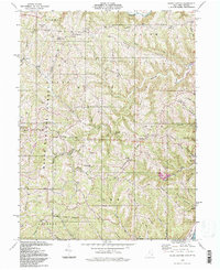
1994 Map of Round Bottom
USGS Topo · Published 1998About this map
Sunfish Creek winds through the northern reaches of this terrain, anchoring a landscape defined by prominent ridges and a network of deep-cut runs. Much of the western and central area is occupied by the Wayne National Forest, where steep slopes like Beautiful Ridge and Opossum Ridge create a fragmented pattern of settlement. Local life is concentrated on the high ground or tucked into the valleys, with numerous small congregations and family burial grounds such as Chapel Hill Ch, Morton Ridge Ch, and the McIntire Cem serving the rural population.
Find a feature on this map
90 named features on this map. Tap any name to fly to it.
Don’t see what you’re looking for? This feature index may not catch every label — zoom into the map to look around manually.
Map Details
Editions of this 1994 Round Bottom Map
This is the sole edition of this map. No revisions or reprints were ever made.
Other maps of this area

1905 · Clarington
USGS Topo · 1:62,500

1905 · New Matamoras
USGS Topo · 1:62,500

1905 · Woodsfield
USGS Topo · 1:62,500

1906 · New Martinsville
USGS Topo · 1:62,500

1924 · New Martinsville
USGS Topo · 1:62,500

1924 · New Matamoras
USGS Topo · 1:62,500

1926 · New Martinsville
USGS Topo · 1:62,500

1926 · New Matamoras
USGS Topo · 1:62,500

1935 · Clarington
USGS Topo · 1:62,500

1940 · Clarington
USGS Topo · 1:62,500