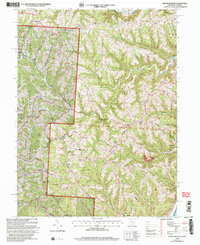
2002 Map of Round Bottom
USGS Topo · Published 2006About this map
Wayne National Forest land dominates the western side of this survey, where the rugged terrain of Monroe County drops toward the Ohio River. The riverfront serves as the primary corridor for settlement and industry, connecting communities like Hannibal and Sardis along the eastern edge of the county. A pattern of high ridges, such as Sykes Ridge and Beautiful Ridge, defines the interior, with narrow runs and creeks carving out deep hollows that historically dictated local travel and land use.
Find a feature on this map
84 named features on this map. Tap any name to fly to it.
Don’t see what you’re looking for? This feature index may not catch every label — zoom into the map to look around manually.
Map Details
Editions of this 2002 Round Bottom Map
This is the sole edition of this map. No revisions or reprints were ever made.
Other maps of this area

1905 · Clarington
USGS Topo · 1:62,500

1905 · New Matamoras
USGS Topo · 1:62,500

1905 · Woodsfield
USGS Topo · 1:62,500

1906 · New Martinsville
USGS Topo · 1:62,500

1924 · New Martinsville
USGS Topo · 1:62,500

1924 · New Matamoras
USGS Topo · 1:62,500

1926 · New Martinsville
USGS Topo · 1:62,500

1926 · New Matamoras
USGS Topo · 1:62,500

1935 · Clarington
USGS Topo · 1:62,500

1940 · Clarington
USGS Topo · 1:62,500