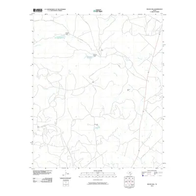
2010 Map of Round Hill
USGS Topo · Published 2010About this map
Round Hill rises as a central landmark in this portion of Shackelford County, anchoring a landscape defined by expansive ranching operations and water management. Large landholdings like Nail Ranch and Cook Ranch dominate the topography, reflecting the region's enduring cattle and oil heritage. The map records several engineered water features essential for this semi-arid environment, including Casey Lake and the sequential Nail Lake Number 1 and Nail Lake Number 2, each supported by their respective dams. A network of ephemeral waterways, such as Taylor Creek, Foyle Creek, and Snailum Creek, carve through the terrain, while infrastructure like Cook Field Rd and Ranch Rd 2482 provide access to remote outposts like Cook Camp. This survey documents a quiet but functional intersection of watershed geography and private ranch management in West Texas.
Find a feature on this map
27 named features on this map. Tap any name to fly to it.
Don’t see what you’re looking for? This feature index may not catch every label — zoom into the map to look around manually.
Map Details
Editions of this 2010 Round Hill Map
This is the sole edition of this map. No revisions or reprints were ever made.
Other maps of this area

1892 · Albany
USGS Topo · 1:125,000

1893 · Albany
USGS Topo · 1:125,000

1954 · Abilene
USGS Topo · 1:250,000

1958 · Abilene
USGS Topo · 1:250,000

1965 · Acampo
USGS Topo · 1:24,000

1965 · Collins Creek
USGS Topo · 1:24,000

1965 · Albany
USGS Topo · 1:24,000
1965 · Collins Creek SW
USGS Topo · 1:24,000

1965 · McCatherine Mountain
USGS Topo · 1:24,000
1965 · Antelope Hills
USGS Topo · 1:24,000