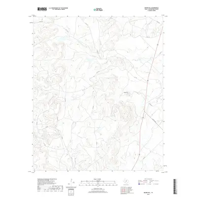
2019 Map of Round Hill
USGS Topo · Published 2019About this map
Round Hill rises as a central topographic landmark in this section of Shackelford County, defining the drainage patterns for numerous seasonal streams and local watersheds. The landscape is characterized by a network of creeks, including Foyle Cr, Taylor Cr, and Miller Cr, which carve through the terrain and eventually feed into larger regional basins. Modern connectivity is maintained through a combination of public thoroughfares like Fm 1084 and Ranch Rd 2482, alongside an extensive web of private ranch roads such as Pvt Rd 1780 and Stasney Rd. A notable point of water storage in this arid environment is Casey Lake, situated south of the namesake hill. This U.S. Geological Survey data reflects the ranching-centric land use of the Texas Rolling Plains, where water features and private access routes are the primary indicators of human presence and land management.
Find a feature on this map
22 named features on this map. Tap any name to fly to it.
Don’t see what you’re looking for? This feature index may not catch every label — zoom into the map to look around manually.
Map Details
Editions of this 2019 Round Hill Map
This is the sole edition of this map. No revisions or reprints were ever made.
Other maps of this area

1892 · Albany
USGS Topo · 1:125,000

1893 · Albany
USGS Topo · 1:125,000

1954 · Abilene
USGS Topo · 1:250,000

1958 · Abilene
USGS Topo · 1:250,000

1965 · Acampo
USGS Topo · 1:24,000

1965 · Collins Creek
USGS Topo · 1:24,000

1965 · Albany
USGS Topo · 1:24,000
1965 · Collins Creek SW
USGS Topo · 1:24,000

1965 · McCatherine Mountain
USGS Topo · 1:24,000
1965 · Antelope Hills
USGS Topo · 1:24,000