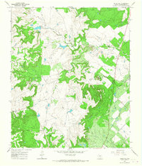
1965 Map of Round Hill
USGS Topo · Published 1967About this map
The rolling ranchlands of Shackelford County are dominated by the extensive energy operations of the mid-1960s, where several large Oil Field zones and scattered Oil Wells define the landscape. The topographic survey centers on the prominent Round Hill and reveals a network of large agricultural holdings, including the Nail Ranch and Cook Ranch, which have long been foundational to the area's cattle-driven economy.
Find a feature on this map
12 named features on this map. Tap any name to fly to it.
Don’t see what you’re looking for? This feature index may not catch every label — zoom into the map to look around manually.
Map Details
Editions of this 1965 Round Hill Map
This is the sole edition of this map. No revisions or reprints were ever made.
Other maps of this area

1892 · Albany
USGS Topo · 1:125,000

1893 · Albany
USGS Topo · 1:125,000

1954 · Abilene
USGS Topo · 1:250,000

1958 · Abilene
USGS Topo · 1:250,000

1965 · Acampo
USGS Topo · 1:24,000

1965 · Collins Creek
USGS Topo · 1:24,000

1965 · Albany
USGS Topo · 1:24,000
1965 · Collins Creek SW
USGS Topo · 1:24,000

1965 · McCatherine Mountain
USGS Topo · 1:24,000
1965 · Antelope Hills
USGS Topo · 1:24,000