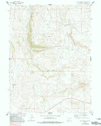
1969 Map of Round Mountain
USGS Topo · Published 1991About this map
Emigrant Trail tracks and high-desert terrain define this 1969 topographic survey of western Wyoming. The historic route of the westward migration is clearly etched across the landscape, paralleling the Emigrant Creek and Slate Creek drainages. This area in Lincoln County reflects the rugged overland travel conditions of the nineteenth century, with water sources like Mud Spring, Emigrant Spring, and Jenkins Springs serving as critical landmarks for travelers. The map reveals a transition from the elevated Slate Creek Ridge down to the intermittent stream beds of the North Fork Slate Creek and South Fork Slate Creek. Notable for local researchers is the presence of Matthews, a lone named location amidst the draws, and The Old Water Well (Flowing), which highlights the vital importance of groundwater in this arid region south of Round Mountain.
Find a feature on this map
21 named features on this map. Tap any name to fly to it.
Don’t see what you’re looking for? This feature index may not catch every label — zoom into the map to look around manually.
Map Details
Editions of this 1969 Round Mountain Map
2 editions found
Other maps of this area

1936 · Cokeville
USGS Topo · 1:96,000

1942 · Cokeville
USGS Topo · 1:125,000

1945 · Fort Hill
USGS Topo · 1:62,500

1947 · Fort Hill
USGS Topo · 1:62,500

1954 · Ogden
USGS Topo · 1:250,000

1954 · Kemmerer
USGS Topo · 1:62,500

1955 · Preston
USGS Topo · 1:250,000

1958 · Ogden
USGS Topo · 1:250,000

1958 · Preston
USGS Topo · 1:250,000

1960 · Ogden
USGS Topo · 1:250,000