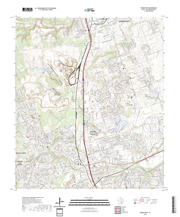
2023 Map of Round Rock
USGS Topo · Published 2023About this map
Round Rock and southern Georgetown are revealed as a dense network of suburban expansion and historical preservation in this contemporary survey. The landscape is defined by the convergence of major corridors like University Blvd and I-35 Frontage Rd, supporting institutions such as Texas State University at Round Rock and the Austin Community College - Round Rock Campus. Despite modern growth, the area retains significant genealogical landmarks, including the Union Hill Cem, Harrell Cem, and a designated Slave Cem near Brushy Creek. This coexistence of institutional development and historic burial grounds provides a clear record of the region's long-standing community structure. Water management is prominent throughout the terrain, with numerous Soil Conservation Service reservoirs like Site 11 Reservoir and Site 17 Reservoir situated among the residential blocks.
Find a feature on this map
57 named features on this map. Tap any name to fly to it.
Don’t see what you’re looking for? This feature index may not catch every label — zoom into the map to look around manually.
Map Details
Editions of this 2023 Round Rock Map
This is the sole edition of this map. No revisions or reprints were ever made.
Other maps of this area

1893 · Georgetown
USGS Topo · 1:125,000

1896 · Austin
USGS Topo · 1:125,000

1897 · Austin
USGS Topo · 1:125,000

1910 · Austin
USGS Topo · 1:125,000

1925 · Georgetown 4-b
USGS Topo · 1:48,000

1925 · Georgetown 4-d
USGS Topo · 1:48,000

1928 · Round Rock
USGS Topo · 1:62,500

1932 · Mt. Bonnell
USGS Topo · 1:62,500

1949 · Round Rock
USGS Topo · 1:62,500

1951 · Round Rock
USGS Topo · 1:62,500