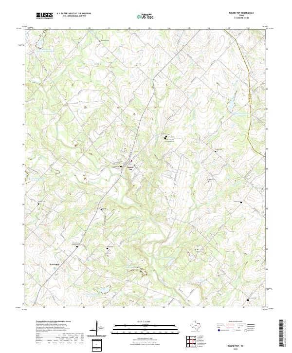
2022 Map of Round Top
USGS Topo · Published 2022About this map
Round Top and the surrounding Fayette County countryside are defined by a dense network of family-named roads and burial grounds, reflecting the deep German-Texan roots of this Central Texas region. The landscape is carved by the winding course of Cummins Cr and its tributaries like Shaw Cr and Rocky Cr. The map reveals a high concentration of small family and community cemeteries, including the Sternberg Cem, Hill Cem, and the notable Richter Hill Cem African American east of the main settlement.
Find a feature on this map
100 named features on this map. Tap any name to fly to it.
Don’t see what you’re looking for? This feature index may not catch every label — zoom into the map to look around manually.
Map Details
Editions of this 2022 Round Top Map
This is the sole edition of this map. No revisions or reprints were ever made.
Other maps of this area

1919 · Fayettsville
USGS Topo · 1:62,500

1919 · Giddings
USGS Topo · 1:62,500

1953 · Seguin
USGS Topo · 1:250,000

1954 · Austin
USGS Topo · 1:250,000

1956 · La Grange
USGS Topo · 1:62,500

1957 · La Grange East
USGS Topo · 1:24,000

1958 · Seguin
USGS Topo · 1:250,000

1958 · Industry
USGS Topo · 1:24,000

1958 · Ledbetter
USGS Topo · 1:24,000

1958 · Greenvine
USGS Topo · 1:24,000