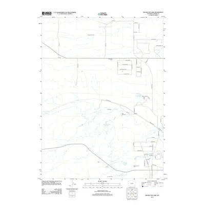
2012 Map of Round Top Lake
USGS Topo · Published 2012About this map
Carpenter Mill Camp and a series of family-named livestock operations define this high plains landscape in Laramie County. The map reveals an area where water management is critical to ranching life, evidenced by the John W Griffen Reservoir, King Reservoir, and Equalizing Reservoir. These impoundments support established holdings like the Wyoming Angus Ranch, Meadowlark Ranch, and Corriedale Ranch.
Find a feature on this map
56 named features on this map. Tap any name to fly to it.
Don’t see what you’re looking for? This feature index may not catch every label — zoom into the map to look around manually.
Map Details
Editions of this 2012 Round Top Lake Map
This is the sole edition of this map. No revisions or reprints were ever made.
Other maps of this area

1905 · Sherman
USGS Topo · 1:125,000

1911 · Cheyenne
USGS Topo · 1:125,000

1914 · Cheyenne
USGS Topo · 1:125,000

1950 · Cheyenne
USGS Topo · 1:62,500

1954 · Cheyenne
USGS Topo · 1:250,000

1958 · Cheyenne
USGS Topo · 1:250,000

1961 · Round Top Lake
USGS Topo · 1:24,000

1961 · Cheyenne South
USGS Topo · 1:24,000
1961 · Borie
USGS Topo · 1:24,000

1961 · Cheyenne
USGS Topo · 1:62,500