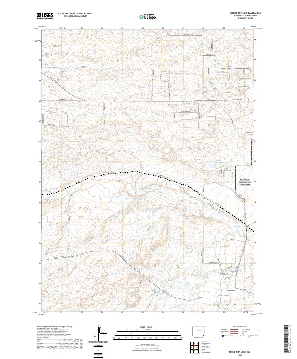
2021 Map of Round Top Lake
USGS Topo · Published 2021About this map
The rolling Laramie County landscape west of Cheyenne is defined by a series of drainages and upland ridges, dominated by the prominent elevation of Round Top. This 2021 survey shows a transition from traditional ranching lands to contemporary rural development, evidenced by labels like Quarter Circle Dr and Cattlemans Dr. Water management is central to this high plains environment, with John W Griffen Reservoir and King Reservoir capturing the seasonal flows of Crow Cr and Diamond Cr. The local geography is further marked by Stevenson Hill and the eponymous Round Top Lake, while road names such as Butch Cassidy Trl and Doc Holliday Av reflect the area's frontier heritage. This map provides a clear picture of how modern infrastructure and named rural developments have integrated into the historical land divisions of t14n r67w and surrounding townships.
Find a feature on this map
70 named features on this map. Tap any name to fly to it.
Don’t see what you’re looking for? This feature index may not catch every label — zoom into the map to look around manually.
Map Details
Editions of this 2021 Round Top Lake Map
This is the sole edition of this map. No revisions or reprints were ever made.
Other maps of this area

1905 · Sherman
USGS Topo · 1:125,000

1911 · Cheyenne
USGS Topo · 1:125,000

1914 · Cheyenne
USGS Topo · 1:125,000

1950 · Cheyenne
USGS Topo · 1:62,500

1954 · Cheyenne
USGS Topo · 1:250,000

1958 · Cheyenne
USGS Topo · 1:250,000

1961 · Round Top Lake
USGS Topo · 1:24,000

1961 · Cheyenne South
USGS Topo · 1:24,000
1961 · Borie
USGS Topo · 1:24,000

1961 · Cheyenne
USGS Topo · 1:62,500