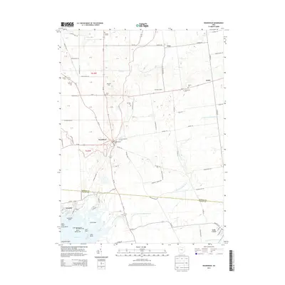
2013 Map of Roundhead
USGS Topo · Published 2013About this map
Roundhead serves as a central hub in this West Central Ohio landscape, where the headwaters of the Scioto River begin their journey through the agricultural plains. The geography is defined by a dense network of township and county roads, reflecting a deeply rooted rural infrastructure that connects small settlements like Jump, Jumbo, and Belle Center. For genealogists, the map is remarkably dense with burial sites, including the New Roundhead and Old Roundhead cemeteries, alongside smaller family or neighborhood plots such as Rutledge Cem, Hinkle Cem, and McArthur Cem. To the south, the terrain transitions into the wetlands and recreational fringes of Indian Lake, featuring a series of named islands and points like Pony Island and Turkeyfoot Point. This survey captures the literal divide of the Hardin and Logan county line, illustrating how historical property divisions and water management via the Poe Ditch have shaped the modern township system.
Find a feature on this map
95 named features on this map. Tap any name to fly to it.
Don’t see what you’re looking for? This feature index may not catch every label — zoom into the map to look around manually.
Map Details
Editions of this 2013 Roundhead Map
This is the sole edition of this map. No revisions or reprints were ever made.
Other maps of this area

1913 · Alger
USGS Topo · 1:48,000

1913 · Bellefontaine
USGS Topo · 1:48,000

1913 · East Liberty
USGS Topo · 1:62,500

1915 · Alger
USGS Topo · 1:62,500

1915 · Bellefontaine
USGS Topo · 1:62,500

1915 · East Liberty
USGS Topo · 1:62,500

1915 · Kenton
USGS Topo · 1:62,500

1943 · Alger
USGS Topo · 1:62,500

1944 · East Liberty
USGS Topo · 1:62,500

1944 · Kenton
USGS Topo · 1:62,500