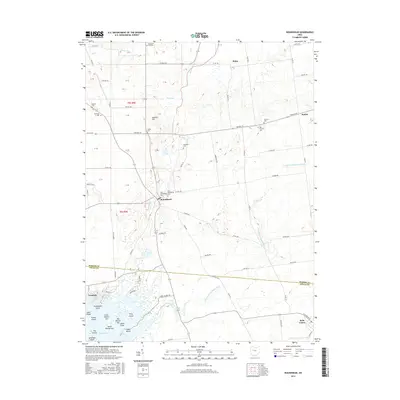
2016 Map of Roundhead
USGS Topo · Published 2016About this map
Roundhead and Belle Center anchor this 2016 survey along the Hardin and Logan county line, where the headwaters of the Scioto River meet the northern reaches of Indian Lake. The landscape is characterized by a high density of ancestral burial sites, including the Old Roundhead Cem, New Roundhead Cem, and the family-named McArthur Cem and Bowdle Cem. These sites, often situated near minor rises like Anstine Hill, offer significant points of interest for genealogists tracing early families in the Scioto valley. Further south, the map details the complex shoreline of Indian Lake, naming numerous landforms such as Turkeyfoot Point, Snow Island, and Pony Island. The drainage patterns of the N Fork Great Miami River and the S Fork Great Miami River illustrate the hydrology that continues to shape this agricultural and recreational corridor.
Find a feature on this map
74 named features on this map. Tap any name to fly to it.
Don’t see what you’re looking for? This feature index may not catch every label — zoom into the map to look around manually.
Map Details
Editions of this 2016 Roundhead Map
This is the sole edition of this map. No revisions or reprints were ever made.
Other maps of this area

1913 · Alger
USGS Topo · 1:48,000

1913 · Bellefontaine
USGS Topo · 1:48,000

1913 · East Liberty
USGS Topo · 1:62,500

1915 · Alger
USGS Topo · 1:62,500

1915 · Bellefontaine
USGS Topo · 1:62,500

1915 · East Liberty
USGS Topo · 1:62,500

1915 · Kenton
USGS Topo · 1:62,500

1943 · Alger
USGS Topo · 1:62,500

1944 · East Liberty
USGS Topo · 1:62,500

1944 · Kenton
USGS Topo · 1:62,500