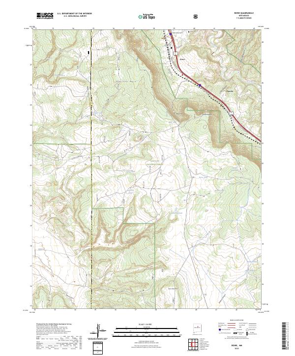
2023 Map of Rowe
USGS Topo · Published 2023About this map
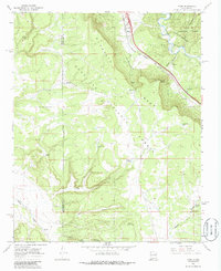
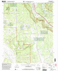
Glorieta Mesa dominates the western half of this northern New Mexico landscape, where the high desert terrain transitions into the protected woodlands of the Santa Fe National Forest. The settlement of Rowe serves as a focal point along the northeastern corridor, situated near the Pecos River and the historic transition from the plains to the mountains. The map reveals a complex network of canyons and mesas, including Cañon Pajarita and Cañon Ancho, which have shaped local movement and settlement for generations.
Find a feature on this map
43 named features on this map. Tap any name to fly to it.
Don’t see what you’re looking for? This feature index may not catch every label — zoom into the map to look around manually.
Map Details
Editions of this 2023 Rowe Map
This is the sole edition of this map. No revisions or reprints were ever made.
Historical Maps of Pajarita Through Time
3 maps found