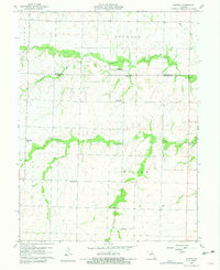
1960 Map of Rowena
USGS Topo · Published 1981About this map
Rowena and its surrounding rural community are centered here along the Monroe Co Audrain Co line during the mid-twentieth century. The landscape is defined by an extensive network of country schools, documenting a period before widespread district consolidation. Locations like Fuller Sch, Excelsior Sch, Goodwater Sch, Strother Sch, and Naylor Sch illustrate the decentralized education system of the time.
Find a feature on this map
20 named features on this map. Tap any name to fly to it.
Don’t see what you’re looking for? This feature index may not catch every label — zoom into the map to look around manually.
Map Details
Editions of this 1960 Rowena Map
2 editions found
Other maps of this area

1890 · Mexico
USGS Topo · 1:125,000

1890 · Moberly
USGS Topo · 1:125,000

1932 · Mexico
USGS Topo · 1:62,500

1945 · Florida
USGS Topo · 1:62,500

1945 · Centralia
USGS Topo · 1:62,500

1948 · Quincy
USGS Topo · 1:250,000

1953 · Moberly
USGS Topo · 1:250,000

1954 · Moberly
USGS Topo · 1:250,000

1956 · Quincy
USGS Topo · 1:250,000

1957 · Moberly
USGS Topo · 1:250,000