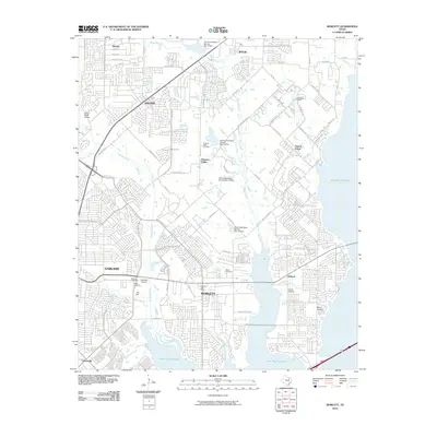
2010 Map of Rowlett
USGS Topo · Published 2010About this map
Lake Ray Hubbard dominates the southeastern quadrant of this North Texas study, its expansive waters meeting the residential edges of Rowlett and Dalrock. By the early 21st century, the suburban landscape had largely replaced the rural character of the area, though remnants of the past remain in the form of numerous small burial grounds. Genealogists can locate Cottonwood Cemetery and Pleasant Valley Cemetery in the north, while Big A Cemetery and McShan Cemetery sit nestled among the growing subdivisions. The terrain is defined by the convergence of several waterways including Rowlett Creek, Muddy Creek, and Maxwell Creek, which are managed by a series of dams like Soil Conservation Service Site 7 Dam. Small local landmarks like the Madeira Airpark and the Ganze Ranch Airstrip reflect the region's diverse land use as it transitioned from open ranching to a thriving residential hub.
Find a feature on this map
69 named features on this map. Tap any name to fly to it.
Don’t see what you’re looking for? This feature index may not catch every label — zoom into the map to look around manually.
Map Details
Editions of this 2010 Rowlett Map
This is the sole edition of this map. No revisions or reprints were ever made.
Other maps of this area

1891 · Dallas
USGS Topo · 1:125,000

1893 · Dallas
USGS Topo · 1:125,000

1912 · Rockwall
USGS Topo · 1:31,680

1919 · Royse City
USGS Topo · 1:62,500

1924 · Farmersville 3-c
USGS Topo · 1:48,000

1924 · Mc Kinney 4-d
USGS Topo · 1:48,000

1929 · McKinney
USGS Topo · 1:62,500

1930 · Farmersville
USGS Topo · 1:62,500

1954 · Dallas
USGS Topo · 1:250,000

1954 · Sherman
USGS Topo · 1:250,000