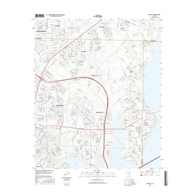
2016 Map of Rowlett
USGS Topo · Published 2016About this map
Rowlett and Garland dominate this suburban landscape on the eastern edge of Dallas County, where the sprawling residential street networks meet the western inlets of Lake Ray Hubbard. The map records a complex web of named roads including Firewheel Pkwy and Town Center Blvd, reflecting the rapid late-century expansion in this corridor. Despite the dense modern development, several pockets of local history remain visible through established burial grounds. Researchers can find the Cottonwood Cem in the north, along with Garland Cem, Miles Cem, and Rowlett Cem further south. Smaller communities and crossroads like Pleasant Valley, Liberty Grove, and Dalrock are integrated into the grid. The terrain is defined by the hydrologic network of Rowlett Cr, Muddy Cr, and Corder Lake, which provide a natural structure to the developed landscape.
Find a feature on this map
197 named features on this map. Tap any name to fly to it.
Don’t see what you’re looking for? This feature index may not catch every label — zoom into the map to look around manually.
Map Details
Editions of this 2016 Rowlett Map
This is the sole edition of this map. No revisions or reprints were ever made.
Other maps of this area

1891 · Dallas
USGS Topo · 1:125,000

1893 · Dallas
USGS Topo · 1:125,000

1912 · Rockwall
USGS Topo · 1:31,680

1919 · Royse City
USGS Topo · 1:62,500

1924 · Farmersville 3-c
USGS Topo · 1:48,000

1924 · Mc Kinney 4-d
USGS Topo · 1:48,000

1929 · McKinney
USGS Topo · 1:62,500

1930 · Farmersville
USGS Topo · 1:62,500

1954 · Dallas
USGS Topo · 1:250,000

1954 · Sherman
USGS Topo · 1:250,000