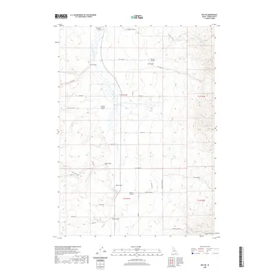
2020 Map of Roy NE
USGS Topo · Published 2020About this map
Rockland Valley dominates the northwestern portion of this Power County landscape, where the S Fork Rock Cr flows through a series of dramatic drainages. The topography is defined by a network of named canyons including Flint Canyon, Big Canyon, and Portage Canyon in the north, transitioning into Hartley Canyon and Side Canyon as one moves south. This region is characterized by a high-desert canyon system where land use is reflected in the numerous named access routes, such as Hartley Canyon Rd and Portage Canyon Rd. The southern extent features Yates Canyon, Goddard Canyon, and Windy Canyon, illustrating a rugged geography shaped by the watershed of the South Fork. The map provides a precise look at the township and range boundaries across T11S and T12S, useful for tracing property and land claims in this part of Idaho.
Find a feature on this map
34 named features on this map. Tap any name to fly to it.
Don’t see what you’re looking for? This feature index may not catch every label — zoom into the map to look around manually.
Map Details
Editions of this 2020 Roy NE Map
This is the sole edition of this map. No revisions or reprints were ever made.
Other maps of this area

1934 · Rockland
USGS Topo · 1:62,500

1937 · Rockland
USGS Topo · 1:62,500

1938 · Pauline
USGS Topo · 1:48,000

1944 · Arbon
USGS Topo · 1:62,500

1954 · Pocatello
USGS Topo · 1:250,000

1958 · Pocatello
USGS Topo · 1:250,000

1971 · Rockland East
USGS Topo · 1:24,000

1971 · Bannock Peak
USGS Topo · 1:24,000

1971 · Rockland West
USGS Topo · 1:24,000

1973 · Hartley Peak
USGS Topo · 1:24,000