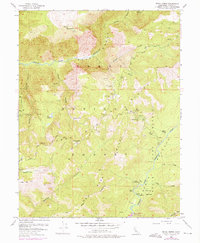
1953 Map of Royal Gorge
USGS Topo · Published 1976About this map
Royal Gorge serves as the dramatic center of this mid-century topographic study, where the North Fork American River carves deeply through the Sierra Nevada within the Tahoe National Forest. The landscape is a network of steep canyons and high ridges, including Snow Mountain and Sunflower Hill. The region's mining heritage is evident through numerous scattered sites such as the Lost Emigrant Mine, Placer Queen Mine, and Walker Mine. Evidence of early recreation and seasonal habitation appears at Gates Cabin and Handy Camp along the river forks. This edition includes purple photogrammetric revisions from 1973, showing the development of the French Meadows Reservoir on the Middle Fork American River, reflecting the era's significant water management changes in the high country.
Find a feature on this map
45 named features on this map. Tap any name to fly to it.
Don’t see what you’re looking for? This feature index may not catch every label — zoom into the map to look around manually.
Map Details
Editions of this 1953 Royal Gorge Map
4 editions found
Other maps of this area

1891 · Colfax
USGS Topo · 1:125,000

1891 · Truckee
USGS Topo · 1:125,000

1892 · Colfax
USGS Topo · 1:125,000

1893 · Truckee
USGS Topo · 1:125,000

1894 · Colfax
USGS Topo · 1:125,000

1895 · Truckee
USGS Topo · 1:125,000

1898 · Colfax
USGS Topo · 1:125,000

1900 · Colfax
USGS Topo · 1:125,000

1902 · Colfax
USGS Topo · 1:125,000

1932 · Truckee
USGS Topo · 1:96,000