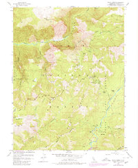
1953 Map of Royal Gorge
USGS Topo · Published 1980About this map
The North Fork American River carves through the dramatic Royal Gorge, anchoring a landscape shaped by mining and wilderness recreation. This mid-century survey captures the rugged interior of the Tahoe National Forest, where a network of remote mining operations once sought fortune along the canyon walls. Notable sites include the Lost Emigrant Mine, Walker Mine, and the Placer Queen Mine, alongside several camps and springs.
Find a feature on this map
52 named features on this map. Tap any name to fly to it.
Don’t see what you’re looking for? This feature index may not catch every label — zoom into the map to look around manually.
Map Details
Editions of this 1953 Royal Gorge Map
4 editions found
Other maps of this area

1891 · Colfax
USGS Topo · 1:125,000

1891 · Truckee
USGS Topo · 1:125,000

1892 · Colfax
USGS Topo · 1:125,000

1893 · Truckee
USGS Topo · 1:125,000

1894 · Colfax
USGS Topo · 1:125,000

1895 · Truckee
USGS Topo · 1:125,000

1898 · Colfax
USGS Topo · 1:125,000

1900 · Colfax
USGS Topo · 1:125,000

1902 · Colfax
USGS Topo · 1:125,000

1932 · Truckee
USGS Topo · 1:96,000