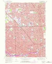
1968 Map of Royal Oak
USGS Topo · Published 1981About this map
The Detroit Zoological Park stands at the heart of this post-war landscape, marking the intersection of growing suburban centers and the northern edge of Detroit. This 1968 revision, updated with purple urban tinting through 1981, documents the densification of Southfield, Royal Oak, and Ferndale during a transformative period for the region. The map reveals a high concentration of educational and religious institutions, including the Lawrence Institute of Technology, Duns Scotus College, and numerous parochial schools like St Mary of Redford High Sch.
Find a feature on this map
106 named features on this map. Tap any name to fly to it.
Don’t see what you’re looking for? This feature index may not catch every label — zoom into the map to look around manually.
Map Details
Editions of this 1968 Royal Oak Map
4 editions found
Other maps of this area

1905 · Wayne
USGS Topo · 1:62,500

1905 · Detroit
USGS Topo · 1:62,500

1907 · Pontiac
USGS Topo · 1:62,500

1908 · Rochester
USGS Topo · 1:62,500

1912 · Wayne
USGS Topo · 1:62,500

1918 · Detroit
USGS Topo · 1:62,500

1924 · Detroit
USGS Topo · 1:62,500

1934 · Detroit
USGS Topo · 1:62,500

1936 · Warren
USGS Topo · 1:31,680

1936 · Inkster
USGS Topo · 1:31,680