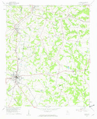
1959 Map of Royston
USGS Topo · Published 1961About this map
The railroad town of Royston anchors this corner of Northeast Georgia, serving as a hub where the Southern tracks meet at the convergence of Franklin, Hart, and Madison counties. In the late 1950s, the landscape was a patchwork of small agrarian settlements and scattered family landmarks, characterized by a high density of rural religious centers like Old Canon Ch and Harmony Grove Ch. The presence of a Mine and numerous small water bodies such as Wilders Pond and Brooks Lake reflects a landscape transitioning from traditional agriculture toward early industrial and recreational uses.
Find a feature on this map
47 named features on this map. Tap any name to fly to it.
Don’t see what you’re looking for? This feature index may not catch every label — zoom into the map to look around manually.
Map Details
Editions of this 1959 Royston Map
2 editions found
Other maps of this area

1891 · Carnesville
USGS Topo · 1:125,000

1893 · Elberton
USGS Topo · 1:125,000

1954 · Greenville
USGS Topo · 1:250,000

1958 · Greenville
USGS Topo · 1:250,000

1958 · Danielsville
USGS Topo · 1:62,500

1958 · Elberton
USGS Topo · 1:62,500

1959 · Carnesville
USGS Topo · 1:24,000

1959 · Lavonia
USGS Topo · 1:24,000

1959 · Royston
USGS Topo · 1:24,000

1959 · Hartwell
USGS Topo · 1:24,000