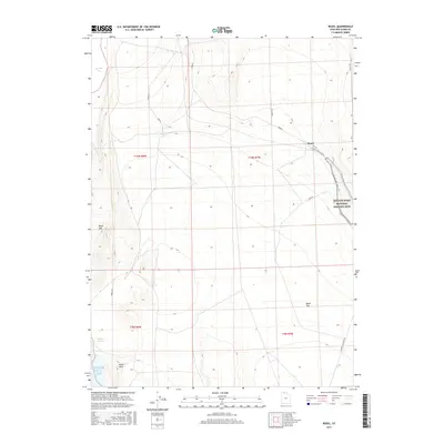
2017 Map of Rozel
USGS Topo · Published 2017About this map
The Golden Spike National Historic Site occupies the eastern portion of this high-desert landscape, preserving the location where the first transcontinental railroad was completed. Located in Box Elder County, the terrain is characterized by the Rozel Hills and Black Mtn, which overlook the expansive Rozel Flat. The western edge of the quadrangle meets the northern reaches of the Great Salt Lake at Spring Bay. Evidence of the area's rail history is reflected in the modern road network, including the Golden Spike Loop Rd and the W Auto Tour Route near the settlement of Rozel. To the southwest, the environment transitions toward the salt flats and the seasonally varying waters of Coyote Ponds, illustrating the stark geography of the eastern Great Basin.
Find a feature on this map
21 named features on this map. Tap any name to fly to it.
Don’t see what you’re looking for? This feature index may not catch every label — zoom into the map to look around manually.
Map Details
Editions of this 2017 Rozel Map
This is the sole edition of this map. No revisions or reprints were ever made.
Other maps of this area

1954 · Brigham City
USGS Topo · 1:250,000

1958 · Brigham City
USGS Topo · 1:250,000

1962 · Brigham City
USGS Topo · 1:250,000

1967 · Golden Spike Monument
USGS Topo · 1:24,000

1968 · Messix Peak
USGS Topo · 1:24,000

1968 · Rozel
USGS Topo · 1:24,000

1968 · Lake Ridge
USGS Topo · 1:24,000

1968 · Sunset Pass
USGS Topo · 1:24,000

1968 · Monument Point
USGS Topo · 1:24,000

1968 · Coyote Point
USGS Topo · 1:24,000