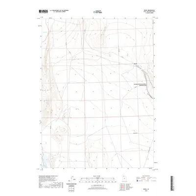
2020 Map of Rozel
USGS Topo · Published 2020About this map
The Golden Spike National Historic Site anchors the eastern edge of this northern Utah landscape, marking the momentous location where the first transcontinental railroad was completed. Moving west from the monument, the terrain transitions into the expansive Rozel Flat, a low-lying area that descends toward the saline waters of the Great Salt Lake. The settlement of Rozel sits along the Golden Spike Loop Rd, serving as a waypoint in a region defined by its connection to early American transportation history. To the northwest, the prominent rise of Black Mtn stands above the marshy reaches of Spring Bay. This 2020 survey illustrates the modern road network, including N Rozel Flats Rd W, overlaid on a landscape that remains sparsely populated and deeply tied to its historical and geological identity.
Find a feature on this map
13 named features on this map. Tap any name to fly to it.
Don’t see what you’re looking for? This feature index may not catch every label — zoom into the map to look around manually.
Map Details
Editions of this 2020 Rozel Map
This is the sole edition of this map. No revisions or reprints were ever made.
Other maps of this area

1954 · Brigham City
USGS Topo · 1:250,000

1958 · Brigham City
USGS Topo · 1:250,000

1962 · Brigham City
USGS Topo · 1:250,000

1967 · Golden Spike Monument
USGS Topo · 1:24,000

1968 · Messix Peak
USGS Topo · 1:24,000

1968 · Rozel
USGS Topo · 1:24,000

1968 · Lake Ridge
USGS Topo · 1:24,000

1968 · Sunset Pass
USGS Topo · 1:24,000

1968 · Monument Point
USGS Topo · 1:24,000

1968 · Coyote Point
USGS Topo · 1:24,000