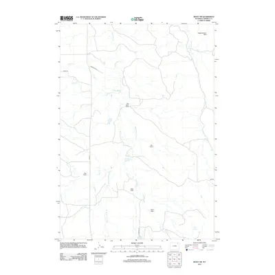
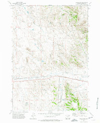
2012 Map of Rozet NW
USGS Topo · Published 2012About this map
Wagonhammer Butte anchors the northeast corner of this high plains landscape, where a complex network of draws and seasonal creek beds carves through the Wyoming prairie. The drainage patterns of the W Fork Cottonwood Cr and Cottonwood Cr dictate the layout of rural access roads like Adon Rd and Biggerstaff Rd. This 2012 survey illustrates a landscape primarily defined by water management and ranching infrastructure, evidenced by named water sources such as Cliff White Reservoir, Jiggs Reservoir, and Lone Cedar Spring. The prevalence of named geographic depressions, including Box Elder Draw, Zoe Draw, and Hamm Draw, reveals a deeply dissected terrain where these ephemeral watercourses are the most significant landmarks for navigation and land division in Campbell County.
Find a feature on this map
20 named features on this map. Tap any name to fly to it.
Don’t see what you’re looking for? This feature index may not catch every label — zoom into the map to look around manually.
Map Details
Editions of this 2012 Rozet NW Map
This is the sole edition of this map. No revisions or reprints were ever made.
Other maps of this area

1954 · Gillette
USGS Topo · 1:250,000

1955 · Gillette
USGS Topo · 1:250,000

1958 · Gillette
USGS Topo · 1:250,000

1962 · Gillette
USGS Topo · 1:250,000

1971 · Rozet
USGS Topo · 1:24,000
1971 · Rozet SE
USGS Topo · 1:24,000
1971 · Rozet NE
USGS Topo · 1:24,000
1971 · Rozet NW
USGS Topo · 1:24,000

1971 · Green Hill
USGS Topo · 1:24,000
1971 · Fortin Draw
USGS Topo · 1:24,000