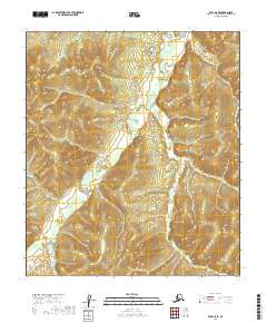
2019 Map of Ruby A-5 SE
USGS Topo · Published 2019About this map
The S Fork Sulatna River meanders through the heart of this Alaska interior landscape, defining a remote drainage system within the Yukon-Koyukuk region. In this high-latitude terrain, the waterway network is the primary organizing structure of the land, with several smaller tributaries such as May Cr and Little Moose Cr feeding into the larger river valleys. The topography is characterized by the complex drainages of Moose Cr and Sunset Cr, illustrating a wild, unsettled landscape where elevation and water define the character of the terrain. Mapping by the U.S. Geological Survey captures the isolation and natural scale of this northern territory, where no roads or settlements are indicated, emphasizing the undisturbed state of the Alaskan wilderness during the early twenty-first century.
Find a feature on this map
11 named features on this map. Tap any name to fly to it.
Don’t see what you’re looking for? This feature index may not catch every label — zoom into the map to look around manually.
Map Details
Editions of this 2019 Ruby A-5 SE Map
This is the sole edition of this map. No revisions or reprints were ever made.
Other maps of this area

1950 · Medfra
USGS Topo · 1:250,000

1951 · Ruby
USGS Topo · 1:250,000

1952 · Ruby A-4
USGS Topo · 1:63,360

1952 · Ruby A-5
USGS Topo · 1:63,360

1952 · Ruby
USGS Topo · 1:250,000

1954 · Medfra D-5
USGS Topo · 1:63,360
1954 · Medfra D-4
USGS Topo · 1:63,360

1959 · Medfra
USGS Topo · 1:250,000

1964 · Ruby
USGS Topo · 1:250,000
2019 · Medfra D-4 NW
USGS Topo · 1:25,000