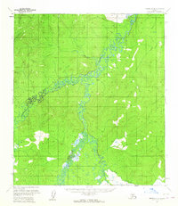
1954 Map of Medfra D-4
USGS Topo · Published 1964About this map
The Nowitna River meanders through a dense network of tributaries in this mid-1950s topographic study of the Alaska interior. The drainage pattern is defined by the significant confluence with the Sulatna River, which joins from the west amidst a complex landscape of wetlands and low-lying drainages. Further south, the Meadow Creek system and its tributary, Bridge Creek, weave through the terrain, illustrating the hydrologic character of the Yukon-Koyukuk region before significant modern development. This area, mapped primarily from aerial photography by the U.S. Geological Survey and the Bureau of Land Management, captures the raw wilderness state of the Kuskokwim Mountains area, where smaller features like Sunrise Creek and Pilot Creek mark the northern reaches of the quadrangle.
Find a feature on this map
6 named features on this map. Tap any name to fly to it.
Don’t see what you’re looking for? This feature index may not catch every label — zoom into the map to look around manually.
Map Details
Editions of this 1954 Medfra D-4 Map
2 editions found
Other maps of this area

1950 · Medfra
USGS Topo · 1:250,000

1951 · Ruby
USGS Topo · 1:250,000

1952 · Ruby A-3
USGS Topo · 1:63,360

1952 · Ruby A-4
USGS Topo · 1:63,360

1952 · Ruby A-5
USGS Topo · 1:63,360

1952 · Ruby
USGS Topo · 1:250,000

1953 · Medfra C-4
USGS Topo · 1:63,360

1954 · Medfra C-5
USGS Topo · 1:63,360

1954 · Medfra D-5
USGS Topo · 1:63,360
1954 · Medfra D-3
USGS Topo · 1:63,360